
Peru is often imagined as a country of mountains.
Machu Picchu, Cusco, the Sacred Valley, and Lake Titicaca dominate most itineraries. Yet before the Andes rise, another Peru stretches along the Pacific coast: dry, windswept, and almost entirely without vegetation.
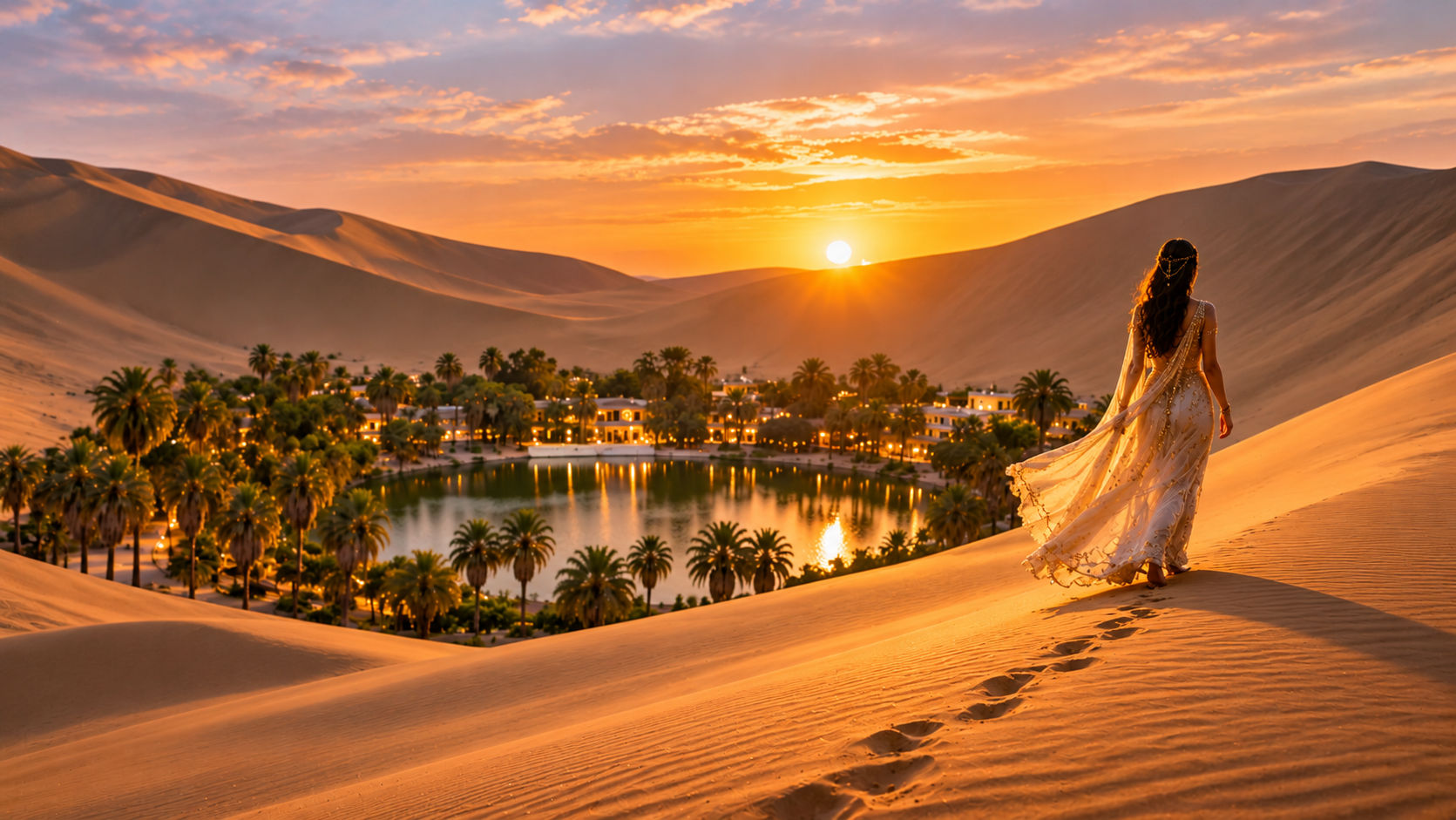
South of Lima, desert cliffs meet the ocean at Paracas. Thousands of seabirds cover the rocks of the Ballestas Islands. Farther inland, Huacachina appears between enormous dunes like a green mirage.
These places are close enough to connect in one journey, but the order matters.
The Paracas National Reserve is best explored on the day you arrive from Lima. The Ballestas Islands belong to the following morning, when boat excursions operate and the sea is generally calmer. Huacachina should come later that day, allowing the dune tour to finish at sunset.
This guide follows the coastal and desert section of our 12-day Peru itinerary:
Lima → Paracas National Reserve → Ballestas Islands → Huacachina → Nazca
Here is how to travel through it without losing time to unnecessary returns or arriving after the experiences you came to see have finished for the day.
Paracas and Huacachina: Day Trip or 2-Day Itinerary?
Paracas and Huacachina are frequently sold together as a long day trip from Lima.
Technically, it can be done.
A traveler can leave Lima before sunrise, take a boat to the Ballestas Islands, transfer to Huacachina, ride through the dunes, and return to the capital late at night.
The result is a collection of photographs connected by hours in a bus.
We recommend slowing your journey down just enough to include the landscapes that most day tours skip.
You spend an afternoon inside the Paracas National Reserve, stay overnight near the bay, visit the Ballestas Islands the next morning, and then continue south to Huacachina. After sunset in the dunes, the route moves onward to Nazca rather than returning to Lima along the same road.
That sequence turns three popular attractions into one continuous journey.
Day 1: Lima to Paracas and Paracas National Reserve
Paracas lies approximately 160 miles south of Lima. Depending on traffic and your departure point, the drive normally takes between 3.5 and 4 hours. For this section of the itinerary, you have two practical options:
- Rent a car in Lima.
- Book a private car with a driver for the entire coastal section.
A rental car offers more independence, but driving in Lima can be stressful, and parts of the Paracas reserve involve rougher roads. Read the rental agreement carefully, especially any clause limiting the vehicle to paved roads.
If you do not feel comfortable driving locally or intend to continue from Huacachina to Nazca after sunset, a private driver makes the route considerably easier.
Whichever option you choose, leave Lima in the morning. Do not plan to reach Paracas late in the afternoon and “see what is still open.”
The Paracas National Reserve entrance is open daily from 9:00 a.m. to 4:00 p.m.
El Chaco, Paracas: Where to Eat and Stay Before Visiting the Reserve
Most visitors use the town of El Chaco as their base in Paracas. What was once a small fishing village is now the region’s tourism center, with hotels, restaurants, excursion offices, and the piers used by boats traveling toward the Ballestas Islands.
Although accommodation listings may simply say “Paracas,” many hotels are located in or around El Chaco. For recommendations on the best areas to stay at every major stop, see our complete guide, Where to Stay in Peru: Best Areas for a Multi-Stop Itinerary.
Have lunch here before entering the reserve, but keep it relatively quick. The town is a better place for a relaxed seafood dinner after the park.
There is no need to check into the hotel first if it would delay your arrival at the reserve. Leave the luggage in the car, confirm the hotel’s parking arrangements in advance, and complete check-in after sightseeing.
Tickets and access to Paracas National Reserve are handled through the Santo Domingo checkpoint. Its official North Tourist Circuit covers approximately 16 miles and can take 4 to 6 hours when explored fully.
Our itinerary uses a selection of its most memorable stops rather than attempting to cover every beach and viewpoint.
Paracas National Reserve: Best Places to Visit and Things to See
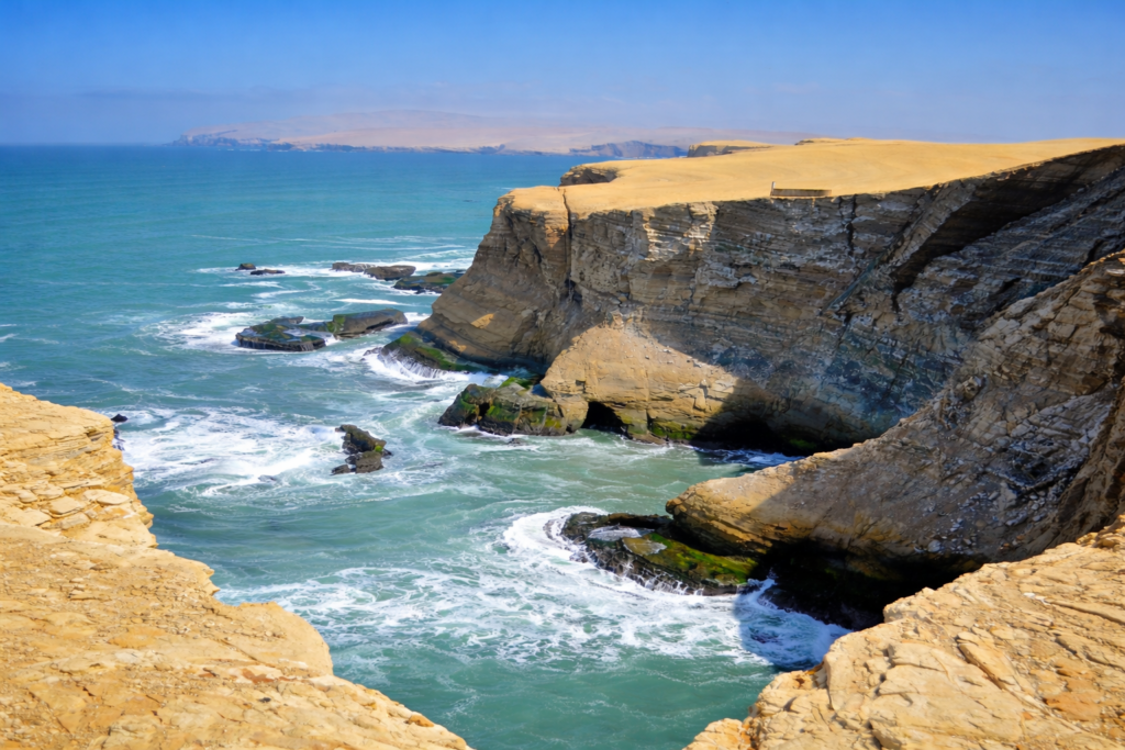
The Paracas National Reserve protects 828,000 acres of desert and marine territory. Approximately 65% of the reserve consists of marine waters. Its ecosystems support hundreds of species of birds, fish, mammals, reptiles, algae, and coastal plants.
What makes Paracas visually extraordinary is not a dense concentration of wildlife on land.
It is the absence of almost everything else.
There are no forests covering the cliffs and very little vegetation softening their outlines. Yellow rock, red sand, dark volcanic beaches, and blue water appear side by side. With so few plants concealing the ground, the landscape exposes millions of years of geological history.
Paracas National Reserve Interpretation Center: What to Know
The reserve’s interpretation center provides context for what you are about to see: the Humboldt Current, migratory birds, desert ecosystems, marine conservation, and the ancient Paracas culture.
The Humboldt Current carries cold, nutrient-rich water northward along the western coast of South America. Those nutrients support plankton, fish, seabirds, penguins, sea lions, and the wider food chain that makes the Peruvian coast so biologically productive.
This is the same natural system that explains the remarkable concentration of wildlife around the Ballestas Islands.
Starting here makes the empty-looking desert easier to read.
Playa Roja: Visiting Paracas’ Famous Red Beach
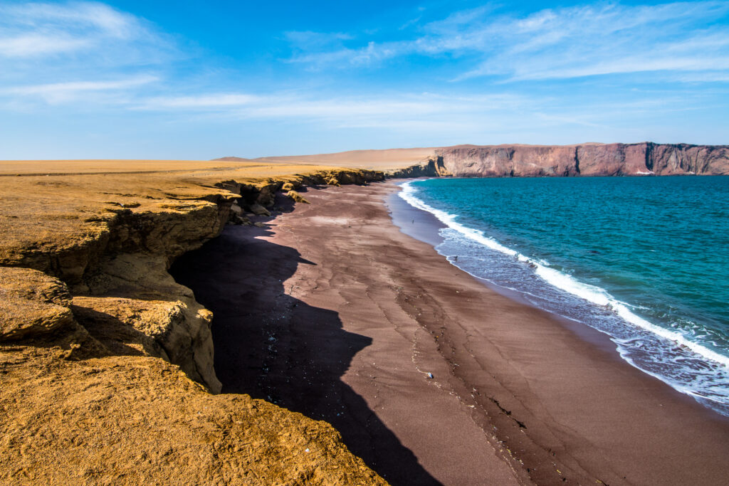
Playa Roja is one of the most distinctive landscapes in the reserve.
Its shore appears red because the beach lies near the Punta Santa María massif, whose rocks contain solidified red magma. Erosion carries fragments of this material toward the water, creating the beach’s unusual color.
The tone changes with the light, shifting between rust, orange, and deep red.
This is primarily a viewpoint rather than a swimming stop. The dramatic contrast between the red shoreline, yellow cliffs, and Pacific Ocean is the reason to visit.
Lagunillas Bay: Best Coastal Viewpoints in Paracas
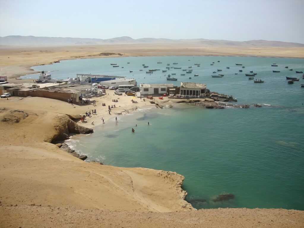
Lagunillas Bay replaces the open coastline with smaller coves, rocky cliffs, pale beaches, and calmer water.
Look for seabirds feeding along the shoreline and fishing boats moving through the bay. The area remains connected to local artisanal fishing, so it feels different from the more exposed viewpoints elsewhere in the reserve.
Facilities are limited once you move away from the main visitor points. Bring water, sunscreen, and anything else you may need for the afternoon.
La Mina and El Raspón: Two Popular Beaches in Paracas
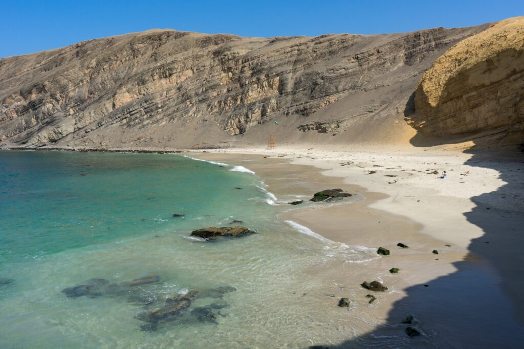
La Mina and El Raspón are among the reserve’s most visited beaches.
La Mina is easier to access and can become crowded, particularly on weekends and public holidays. El Raspón is a useful alternative nearby, reached by steps descending from the cliff.
Whether swimming is practical depends on the day’s conditions. Follow the park rangers’ instructions rather than assuming that every apparently calm beach is safe.
La Catedral and Supay Beach: Dramatic Coastal Landscapes
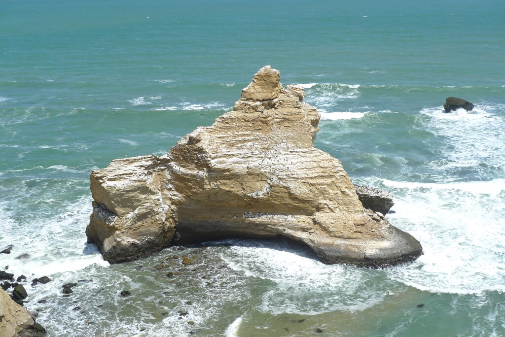
La Catedral was once a natural stone arch shaped by centuries of wind and marine erosion. Much of it collapsed during the powerful earthquake that struck the region in 2007.
The original “cathedral” no longer exists in its famous form, but the viewpoint remains one of the reserve’s best places to understand the scale of the cliffs and the force continually reshaping this coastline.
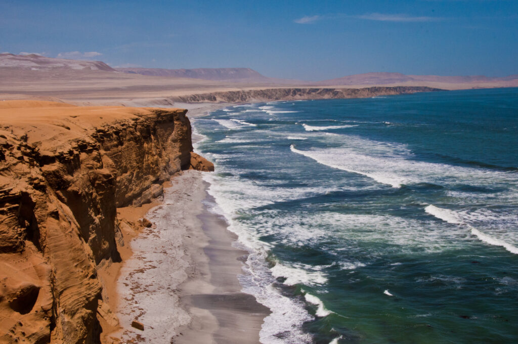
Nearby Supay Beach creates another striking contrast: dark sand below bright yellow rock.
Swimming is prohibited here because of the strong surf.
Paracas Candelabra: Why You Should Visit by Boat
On the northern side of the Paracas Peninsula, a huge geoglyph has been cut into the desert hillside.
Known as the Candelabro de Paracas, it measures approximately 590 feet from top to bottom. Its age, purpose, and creators remain uncertain.
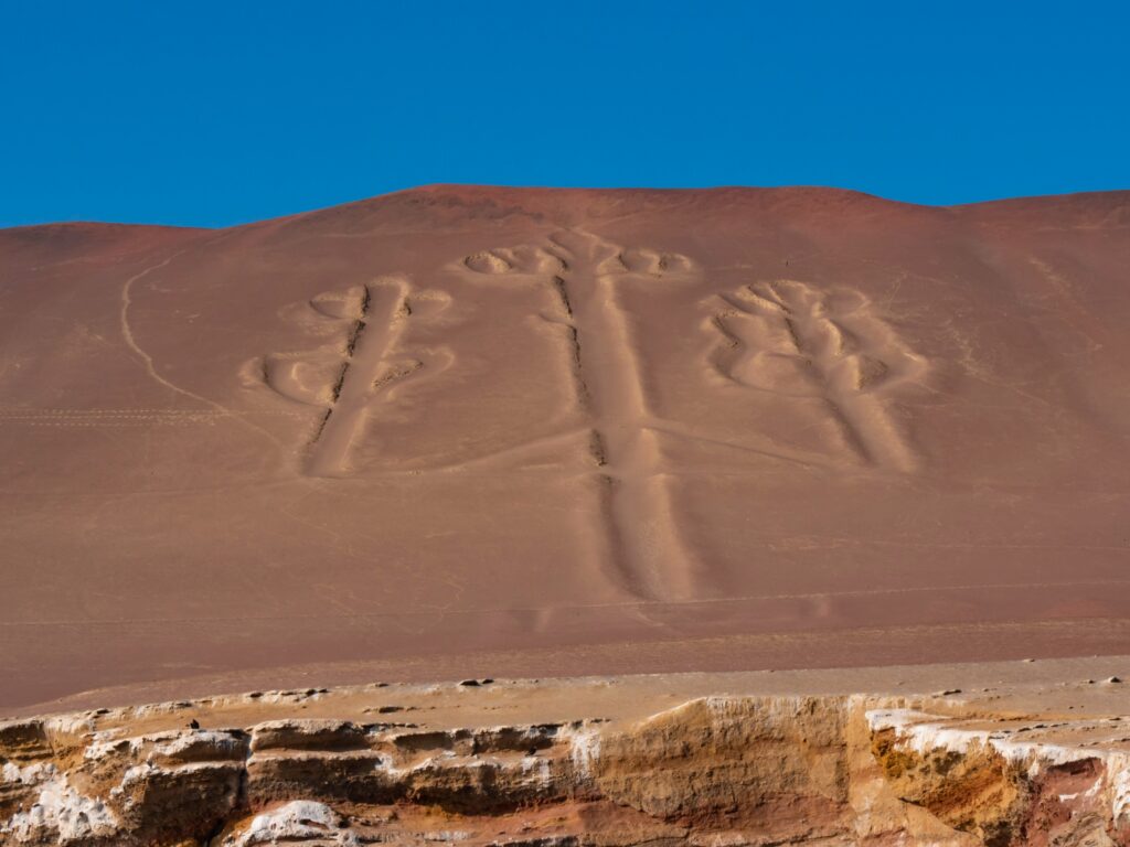
It has been described as a navigational marker, a representation of a plant, a trident associated with the creator god Viracocha, and even a symbol created much later than the Paracas culture. None of these explanations has been definitively proven.
Although the Candelabro is often compared with the Nazca Lines, it is a separate monument in a different location.
Its position was designed, or at least happens, to be most impressive from the sea. The following morning’s boat trip provides the appropriate viewpoint, so there is no reason to add a difficult land detour on the first day.
Where to Stay in Paracas Before the Ballestas Islands Tour
After the reserve, return to El Chaco and check into your hotel.
Staying here serves a practical purpose: the next morning begins at the pier.
The town is small enough to explore on foot, and the waterfront has numerous restaurants specializing in ceviche, grilled octopus, scallops, and the day’s catch.
Do not leave the Ballestas excursion until breakfast the next morning. Arrange it online or through an authorized local operator before the trip or confirm it soon after reaching Paracas.
The islands can only be visited with an operator authorized by Peru’s protected-areas authority. Official visiting hours currently run from 6:00 a.m. to 1:00 p.m.
Choose a departure between 8:00 and 10:00 a.m. The excursion takes approximately two hours and should finish by 12:00 p.m., leaving enough time to continue toward Ica and Huacachina.
Day 2: Ballestas Islands Boat Tour and Huacachina Desert Adventure
Check out of the hotel before the excursion and leave your luggage securely stored with the hotel or inside your vehicle.
Boats currently depart from El Chaco Pier. Confirm the precise meeting point with your operator and arrive at least 15 minutes before departure. The complete excursion generally takes around two hours, although duration depends on the operator and sea conditions.
Even when Paracas feels warm on land, the boat can be cold and windy. Bring:
- A windbreaker
- Sunglasses
- A secure hat
- Sunscreen
- Water
- Medication if you are prone to motion sickness
- A protective case or strap for your phone or camera
Remain seated when instructed, avoid sudden movements, and never feed the animals. The boat approaches the islands for observation but does not land.
Paracas Candelabra: What You’ll See on the Ballestas Islands Boat Tour
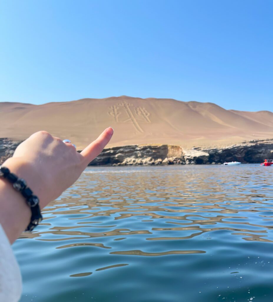
Soon after leaving the bay, the boat turns toward the northern slope of the Paracas Peninsula.
From the water, the Candelabro becomes visible as a huge three-branched figure carved into the pale hillside.
Its lines have survived strong coastal winds partly because of their position and the region’s extremely dry climate. Yet the geoglyph remains vulnerable to erosion and human activity, which is why close access is restricted.
Seen from the boat, the figure does not offer a clear explanation of its purpose.
That uncertainty is part of the experience.
Ballestas Islands vs. Paracas National Reserve: What’s the Difference?
Paracas National Reserve and the Ballestas Islands are usually marketed together, but they are administratively distinct protected areas.
The islands belong to Peru’s National Reserve System of Islands, Islets, and Guano Points.
Ballestas consists of three principal islands – North, Central, and South – whose rocks have been carved by the ocean into arches, caves, narrow passages, and steep cliffs.
There are no walking paths or visitor facilities. The wildlife is the attraction.
Ballestas Islands Wildlife: Penguins, Sea Lions, and Seabirds

The cold, nutrient-rich Humboldt Current supports an unusually productive marine ecosystem. Depending on the season and conditions, the boat route may reveal:
- South American sea lions resting on rocks
- Humboldt penguins moving along the cliffs
- Peruvian pelicans
- Guanay cormorants
- Peruvian boobies and other guano birds
- Dolphins in the surrounding water
Wildlife sightings are never guaranteed. The boat remains at a respectful distance, and what you see depends on migration, breeding seasons, weather, and sea conditions.
One of the islands’ most important features is their role as a resting and breeding area. During the sea-lion breeding season, parts of the shoreline become natural nurseries where mothers remain with their pups.
The noise can be as memorable as the view: sea lions bark from the rocks while thousands of birds circle above them.
The History of Guano Mining on Peru’s Ballestas Islands
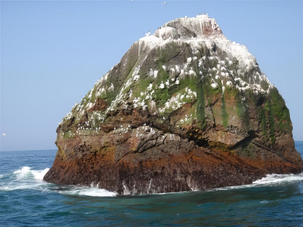
The pale layers covering parts of the islands are guano — dried droppings left by the enormous colonies of seabirds that have nested here for generations.
Guano is naturally rich in nitrogen, phosphorus, and potassium, which makes it an effective fertilizer. Andean communities used it in agriculture long before the arrival of Europeans.
During the nineteenth century, international demand turned Peruvian guano into one of the country’s most valuable exports. It became known as “white gold.”
Intensive extraction, however, disturbed nesting colonies and damaged the islands’ fragile ecosystems. Today, guano harvesting is regulated, and the islands are protected as an important wildlife habitat and part of Peru’s natural and economic history.
Paracas to Ica: Driving Time, Distance, and Travel Tips
After returning to El Chaco, collect your luggage and begin the drive south.
Paracas and Ica are separated by approximately 45 miles. Allow around one to one and a half hours, depending on traffic and your exact route.
This is where the landscape begins to change again.
The ocean disappears behind you, agriculture appears around irrigated sections of the Ica Valley, and dunes rise beyond the cultivated land.
Stop in Ica for lunch before continuing to Huacachina.
Ica generally offers a wider choice of restaurants than the oasis and provides an opportunity to try regional dishes, local wine, or pisco. If you are joining a dune-buggy tour afterward, keep alcohol for another evening.
Huacachina Oasis: What to See and Do in Peru’s Desert
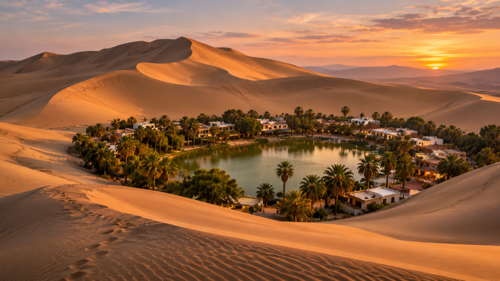
Huacachina lies approximately five kilometers from central Ica, a drive of about 15 minutes.
At its center is a small lagoon surrounded by palms, huarango trees, hotels, restaurants, and a ring of immense dunes.
The lagoon and surrounding subtropical desert are now protected as the Huacachina Lagoon Regional Conservation Area.
The oasis looks isolated in many photographs, but it is not a remote settlement in the middle of an endless desert. Ica lies just beyond the dunes. That does not make the first view any less surprising.
Climb partway up one of the dunes, turn back, and the hotels and palm trees appear compressed around the green water below.
The Legend of Huacachina: Peru’s Desert Mermaid
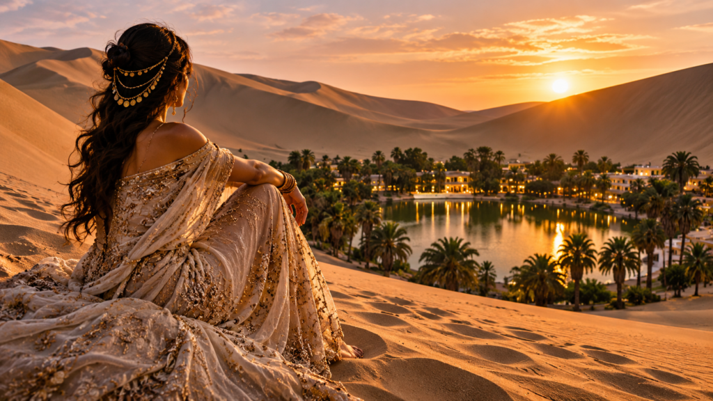
Several versions of Huacachina’s origin story exist.
In one, a young woman was bathing when she saw a hunter watching her. She fled, leaving the water behind, while the folds of her dress became the surrounding dunes. The woman remained in the lagoon as a mermaid.
Another tradition describes the water as the tears of a woman mourning her lost love. Peru’s official tourism site connects the name Huacachina with a “weeping woman.”
The stories differ, but both turn the lagoon into something more than an accidental pool of water.
Before the dune tour, allow approximately 30 to 45 minutes to walk around the oasis and view it from above. Do not spend so long climbing that you miss your booked departure.
Huacachina Dune Buggy and Sandboarding Tours at Sunset
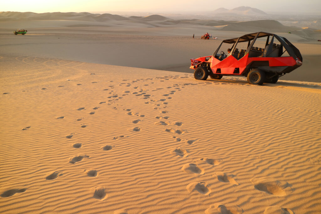
The most popular way to explore the desert is on a combined dune-buggy and sandboarding excursion.
The buggy carries passengers far beyond the built-up oasis, climbing steep ridges before descending into the hollows between the dunes.
At selected slopes, the guide stops and provides boards for sandboarding.
Beginners are normally encouraged to descend lying on their stomachs with their elbows raised rather than attempting to stand immediately. Listen carefully to the guide’s instructions: sand creates different resistance from snow, and falls can still cause injuries.
Book this activity in advance, particularly if you want the late-afternoon departure. Sunset tours are the most popular because they combine cooler temperatures with the best light over the dunes. Before paying, confirm:
- The tour’s departure and return times
- Whether sandboards are included
- Whether the sunset stop is included
- Whether the buggy has individual seat belts
- The operator’s age or health restrictions
- Where the group meets
Wear closed shoes and clothes you do not mind filling with sand. Keep your phone in a zipped pocket or attached to a secure strap.
The ride is intentionally fast and rough. Travelers with back or neck problems, recent surgery, pregnancy, or other relevant medical conditions should ask the operator whether the activity is appropriate before booking.
Huacachina to Nazca: Where to Stay After Your Desert Tour
After the dune buggy and sandboarding tour, have dinner in Huacachina and continue approximately 93 miles south to Nazca. The drive takes around 2.5 hours.
Staying overnight in Nazca positions you for the following morning’s scenic flight over the Nazca Lines. The flight departs from María Reiche Neuman Airport and involves a series of steep turns so that passengers on both sides of the small aircraft can see the geoglyphs.
Bring your original passport and, if you are prone to motion sickness, consider flying before breakfast. After landing, have brunch in Nazca before continuing toward Lima.
This is the sequence used in the TravUp route – The Perfect Peru Itinerary: 12 Days in the Land of Hidden Cities.
What to Book in Advance for Paracas, Ballestas Islands, and Huacachina
Reserve the experiences that control the timing of the route:
Where to Stay in Paracas for an Early Ballestas Islands Tour
Stay within easy reach of El Chaco Pier or the Paracas Tourist Marina. The purpose of this night is to make the early boat departure simple.
How to Book a Ballestas Islands Boat Tour
Use an authorized operator and choose a morning departure. Morning tours fit the onward drive to Ica and Huacachina and leave some flexibility if the schedule changes.
How to Book a Huacachina Buggy and Sandboarding Tour
Book the late-afternoon or sunset departure in advance. These times are the first to sell out.
Transportation From Lima to Paracas, Huacachina, and Nazca
Arrange the rental car or private driver before reaching Peru. If renting, check insurance, mileage limits, road restrictions, the deposit, and whether travel on the roads used inside Paracas is permitted.
For a full overview of reservations, transportation, and preparation for the country, see our Peru trip preparation guide.
Paracas, Ballestas Islands, and Huacachina: Essential Travel Tips
Paracas National Reserve
- Open daily from 9:00 a.m. to 4:00 p.m.
- Entry is through the Santo Domingo checkpoint.
- Check the official SERNANP portal shortly before visiting because hours, routes, access, and fees can change.
Ballestas Islands
- Official visiting hours currently run from 6:00 a.m. to 1:00 p.m.
- Visitors must use a SERNANP-authorized tour operator.
- Boats depart from El Chaco Pier or the Paracas Tourist Marina.
- The islands can be visited throughout the year.
- Excursions may be delayed or cancelled because of sea or weather conditions.
Huacachina
- Located about three miles from Ica
- Buggy and sandboarding tours should be booked in advance
- Carry sunscreen, water, cash, closed shoes, and a windbreaker for the evening
- Expect sand to get into shoes, bags, pockets, and camera equipment.
Explore Paracas and Huacachina With TravUp’s 12-Day Peru Itinerary
This two-day journey through Paracas, the Ballestas Islands, and Huacachina is part of TravUp’s complete 12-day itinerary across Peru.
TravUp brings the complete sequence together with maps, timing, transportation guidance, reservations, and immersive audio stories, allowing you to travel independently without rebuilding the itinerary at every stop.
Explore the complete 12-day Peru itinerary and download the TravUp mobile app (iOS / Android) to take the route with you.